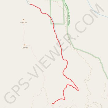
Tiger Creek Trail in Umatilla National Forest
- Distance: 3.7 mi
- Elevation gain: 524 m
- Maximum elevation: 1,359 m
- Elevation loss: 44 m
- Minimum elevation: 871 m
- Moving time: 1 h 50 m
- Moving speed: 2.0 mph
- Maximum speed: 3.6 mph
- Total time: 1 h 59 m
- Global speed: 1.9 mph
Interactive trail map
Trail profile
- Distance: 3.7 mi
- Elevation gain: 524 m
- Maximum elevation: 1,359 m
- Elevation loss: 44 m
- Minimum elevation: 871 m
- Moving time: 1 h 50 m
- Moving speed: 2.0 mph
- Maximum speed: 3.6 mph
- Total time: 1 h 59 m
- Global speed: 1.9 mph
About this trail
Name: Tiger Creek Trail in Umatilla National Forest trail, distance, elevation, map, profile, GPS track
Start: Tiger Canyon Road, Umatilla County, Oregon, United States (45.97584 -118.04139)
End: Government Mountain Road, Umatilla County, Oregon, United States (45.94424 -118.03130)
Coordinates: 45.94424 -118.04139 45.97584 -118.01931