Lake Tormont Trails
- Distance: 6.4 mi
- Elevation gain: 96 m
- Maximum elevation: 225 m
- Elevation loss: 95 m
- Minimum elevation: 176 m
Interactive trail map
Trail profile
- Distance: 6.4 mi
- Elevation gain: 96 m
- Maximum elevation: 225 m
- Elevation loss: 95 m
- Minimum elevation: 176 m
About this trail
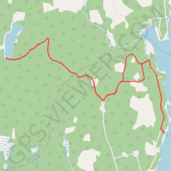
Name: Lake Tormont Trails trail, distance, elevation, map, profile, GPS track
Coordinates: 44.73395 -64.78180 44.75040 -64.74289
Other hiking, mountain biking, running and outdoor activity trails
Click on a trail to view its statistics, map and profile.
Lake Tormont Hiking
Canada > Nova Scotia > Municipality of the County of Kings > East Dalhousie
Distance: 9.9 mi • Elevation gain: 156 m • Maximum elevation: 226 m