Make a donation
Gear up for your next adventure:
As an Amazon Associate, this site earns from qualifying purchases at no extra cost to you.
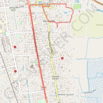
Tracked with OSMTracker for Android™
Kalarcode MDR ride
- Distance: 3.8 mi
- Elevation gain: 9 m
- Maximum elevation: 11 m
- Elevation loss: 10 m
- Minimum elevation: 4 m
- Moving time: 16 m 33 s
- Moving speed: 13.8 mph
- Maximum speed: 27.8 mph
- Total time: 21 m 8 s
- Global speed: 10.8 mph
Interactive trail map
Make a donation
Gear up for your next adventure:
As an Amazon Associate, this site earns from qualifying purchases at no extra cost to you.
Trail profile
- Distance: 3.8 mi
- Elevation gain: 9 m
- Maximum elevation: 11 m
- Elevation loss: 10 m
- Minimum elevation: 4 m
- Moving time: 16 m 33 s
- Moving speed: 13.8 mph
- Maximum speed: 27.8 mph
- Total time: 21 m 8 s
- Global speed: 10.8 mph
Make a donation
Gear up for your next adventure:
As an Amazon Associate, this site earns from qualifying purchases at no extra cost to you.
About this trail
Name: Tracked with OSMTracker for Android™ trail, distance, elevation, map, profile, GPS track
Start: Alappuzha, Ambalappuzha, Alappuzha, Kerala, 688001, India (9.46642 76.34316)
End: Mathapithabhavan, Paravoor, Ambalappuzha, Alappuzha, Kerala, 688004, India (9.44226 76.34350)
Coordinates: 9.44226 76.33926 9.46662 76.35055
Make a donation
Gear up for your next adventure:
As an Amazon Associate, this site earns from qualifying purchases at no extra cost to you.
Other hiking, mountain biking, running and outdoor activity trails
Click on a trail to view its statistics, map and profile.
20240210100212
India > Kerala > Ambalappuzha > Paravoor
Distance: 3.5 mi • Elevation gain: 11 m • Maximum elevation: 11 m