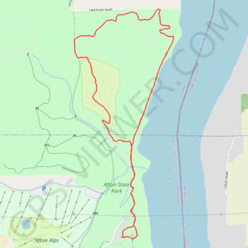
North River Loop Trail in Afton State Park
The North River Loop Trail offers a dynamic hiking experience with diverse landscapes, including river views, lush forests, and open meadows. Along the route, hikers can spot a variety of wildlife, including bald eagles, and enjoy picturesque vistas over the St. Croix River. With moderate elevation changes and some rugged stretches, this trail provides a satisfying challenge while showcasing the park's natural beauty, making it a great choice for nature enthusiasts and photographers alike. #Hiking #Loop #River #Forest #Nature
- Distance: 4.0 mi
- Elevation gain: 161 m
- Maximum elevation: 301 m
- Elevation loss: 161 m
- Minimum elevation: 211 m
- Moving time: 1 h 30 m
- Moving speed: 2.6 mph
- Maximum speed: 3.9 mph
- Total time: 1 h 31 m
- Global speed: 2.6 mph
Interactive trail map
Trail profile
- Distance: 4.0 mi
- Elevation gain: 161 m
- Maximum elevation: 301 m
- Elevation loss: 161 m
- Minimum elevation: 211 m
- Moving time: 1 h 30 m
- Moving speed: 2.6 mph
- Maximum speed: 3.9 mph
- Total time: 1 h 31 m
- Global speed: 2.6 mph
About this trail
Name: North River Loop Trail in Afton State Park trail, distance, elevation, map, profile, GPS track
Coordinates: 44.85325 -92.78149 44.87292 -92.76947
Other hiking, mountain biking, running and outdoor activity trails
Click on a trail to view its statistics, map and profile.
Afton State Park Trails
United States > Minnesota > Washington County > Denmark Township
Distance: 12.6 mi • Elevation gain: 388 m • Maximum elevation: 307 m