Import a GPX file

Parlee Brook Amphitheatre

#Hiking #Snowshoeing

  • Distance: 4.1 mi
  • Elevation gain: 308 m
  • Maximum elevation: 309 m
  • Elevation loss: 308 m
  • Minimum elevation: 114 m

Interactive trail map

Trail profile

  • Distance: 4.1 mi
  • Elevation gain: 308 m
  • Maximum elevation: 309 m
  • Elevation loss: 308 m
  • Minimum elevation: 114 m

About this trail

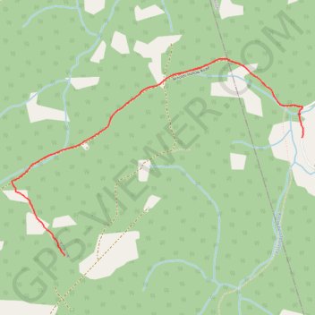
Name: Parlee Brook Amphitheatre trail, distance, elevation, map, profile, GPS track

Start: Parlee Brook Road, Waterford Parish, Kings County, New Brunswick, E4E 5C5, Canada (45.64954 -65.40813)

End: Parlee Brook Road, Waterford Parish, Kings County, New Brunswick, E4E 5C5, Canada (45.64954 -65.40813)

Coordinates: 45.64235 -65.43344 45.65435 -65.40804

Gear up for your next adventure:

🧣Neck Gaiters - Versatile protection against wind and cold
🔋Rechargeable Batteries - Eco-friendly power for headlamps and older GPS units
🔦Keychain LED Torches - Emergency backup light for finding gear in your pack
🧵Survival Paracord - Multi-purpose cordage for emergency repairs and shelters
🚲Bikepacking Frame Bags - Storage for tools and navigation gear on long off-road rides

As an Amazon Associate, this site earns from qualifying purchases at no extra cost to you.