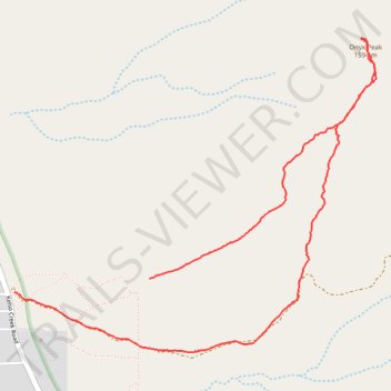
Onyx Peak loop
- Distance: 3.9 mi
- Elevation gain: 648 m
- Maximum elevation: 1,585 m
- Elevation loss: 739 m
- Minimum elevation: 846 m
- Moving time: 3 h 18 s
- Moving speed: 1.3 mph
- Maximum speed: 4.2 mph
- Total time: 8 h 28 s
- Global speed: 0.5 mph
Interactive trail map
Trail profile
- Distance: 3.9 mi
- Elevation gain: 648 m
- Maximum elevation: 1,585 m
- Elevation loss: 739 m
- Minimum elevation: 846 m
- Moving time: 3 h 18 s
- Moving speed: 1.3 mph
- Maximum speed: 4.2 mph
- Total time: 8 h 28 s
- Global speed: 0.5 mph
About this trail
Name: Onyx Peak loop trail, distance, elevation, map, profile, GPS track
Start: Kern County, California, United States (35.64435 -118.24043)
End: 4221, Kelso Creek Road, Weldon, Kern County, California, 93283, United States (35.64362 -118.24912)
Coordinates: 35.64046 -118.24912 35.65694 -118.22579