Dauset Trails Nature Center
- Distance: 13.8 mi
- Elevation gain: 254 m
- Maximum elevation: 205 m
- Elevation loss: 254 m
- Minimum elevation: 164 m
- Moving time: 1 h 45 m
- Moving speed: 7.9 mph
- Maximum speed: 18.4 mph
- Total time: 2 h 1 m
- Global speed: 6.8 mph
Interactive trail map
Trail profile
- Distance: 13.8 mi
- Elevation gain: 254 m
- Maximum elevation: 205 m
- Elevation loss: 254 m
- Minimum elevation: 164 m
- Moving time: 1 h 45 m
- Moving speed: 7.9 mph
- Maximum speed: 18.4 mph
- Total time: 2 h 1 m
- Global speed: 6.8 mph
About this trail
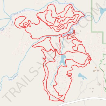
Name: Dauset Trails Nature Center trail, distance, elevation, map, profile, GPS track
Coordinates: 33.23236 -83.95883 33.24920 -83.94298
Other hiking, mountain biking, running and outdoor activity trails
Click on a trail to view its statistics, map and profile.
Dauset Trails Biking Trailhead
United States > Georgia > Butts County
Distance: 21.1 mi • Elevation gain: 357 m • Maximum elevation: 204 m
Dauset Trails Nature Center
United States > Georgia > Butts County
Distance: 31.2 mi • Elevation gain: 507 m • Maximum elevation: 206 m