Digby - Wilmot
Interactive trail map
Trail profile
- Distance: 51.7 mi
- Elevation gain: 658 m
- Maximum elevation: 63 m
- Elevation loss: 655 m
- Minimum elevation: -1 m
About this trail
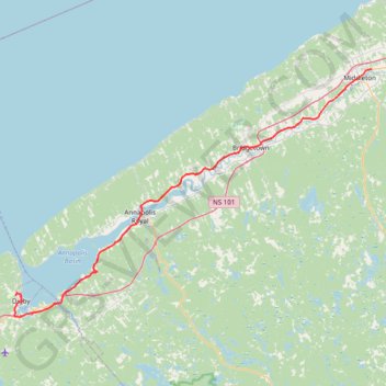
Name: Digby - Wilmot trail, distance, elevation, map, profile, GPS track
Coordinates: 44.59599 -65.77168 44.95405 -65.04340
Other hiking, mountain biking, running and outdoor activity trails
Click on a trail to view its statistics, map and profile.