Dr. Kron homesite tour
- Distance: 0.7 mi
- Elevation gain: 12 m
- Maximum elevation: 140 m
- Elevation loss: 13 m
- Minimum elevation: 127 m
- Moving time: 30 m 37 s
- Moving speed: 1.3 mph
- Maximum speed: 2.3 mph
- Total time: 1 h 34 m
- Global speed: 0.4 mph
Interactive trail map
Trail profile
- Distance: 0.7 mi
- Elevation gain: 12 m
- Maximum elevation: 140 m
- Elevation loss: 13 m
- Minimum elevation: 127 m
- Moving time: 30 m 37 s
- Moving speed: 1.3 mph
- Maximum speed: 2.3 mph
- Total time: 1 h 34 m
- Global speed: 0.4 mph
About this trail
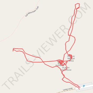
Name: Dr. Kron homesite tour trail, distance, elevation, map, profile, GPS track
Start: Long Loop, Stanly County, North Carolina, 28009, United States (35.38066 -80.07765)
End: Long Loop, Stanly County, North Carolina, 28009, United States (35.38070 -80.07763)
Coordinates: 35.38066 -80.07968 35.38280 -80.07763