Fortynine Palms Oasis in Joshua Tree National Park
The Fortynine Palms Trail offers a scenic and somewhat strenuous journey into the heart of Joshua Tree National Park. As hikers ascend the ridge, they are treated to panoramic desert views, featuring stark rocky landscapes and vibrant desert flora like barrel cacti, creosote bushes, and the occasional spiny lizard. The oasis itself, a surprising pocket of greenery with tall California fan palms, provides a tranquil escape with its cool shade and refreshing pools, despite the surrounding barren, sun-scorched desert. #Hiking #Desert #Nature
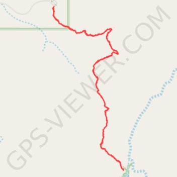
- Distance: 3.1 mi
- Elevation gain: 211 m
- Maximum elevation: 939 m
- Elevation loss: 211 m
- Minimum elevation: 830 m
- Moving time: 1 h 36 m
- Moving speed: 1.9 mph
- Maximum speed: 3.6 mph
- Total time: 1 h 47 m
- Global speed: 1.8 mph
Interactive trail map
Trail profile
- Distance: 3.1 mi
- Elevation gain: 211 m
- Maximum elevation: 939 m
- Elevation loss: 211 m
- Minimum elevation: 830 m
- Moving time: 1 h 36 m
- Moving speed: 1.9 mph
- Maximum speed: 3.6 mph
- Total time: 1 h 47 m
- Global speed: 1.8 mph
About this trail
Name: Fortynine Palms Oasis in Joshua Tree National Park trail, distance, elevation, map, profile, GPS track
Start: Fortynine Palms Trail, San Bernardino County, California, United States (34.11922 -116.11212)
End: Fortynine Palms Trail, San Bernardino County, California, United States (34.11925 -116.11212)
Coordinates: 34.10609 -116.11222 34.11925 -116.10534
Other hiking, mountain biking, running and outdoor activity trails
Click on a trail to view its statistics, map and profile.