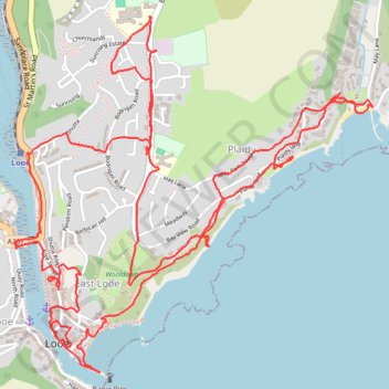
Looe
- Distance: 6.4 mi
- Elevation gain: 357 m
- Maximum elevation: 105 m
- Elevation loss: 357 m
- Minimum elevation: 0 m
Interactive trail map
Trail profile
- Distance: 6.4 mi
- Elevation gain: 357 m
- Maximum elevation: 105 m
- Elevation loss: 357 m
- Minimum elevation: 0 m
About this trail
Name: Looe trail, distance, elevation, map, profile, GPS track
Coordinates: 50.35111 -4.45675 50.36478 -4.43519
Topography: Cornwall topographic map, elevation, terrain