Import a GPX file

Shepherds Gully - Devines Hill - Finchs Line

Dharug National Park. #Hiking #MTB #Loop #Dharug

  • Distance: 8.9 mi
  • Elevation gain: 505 m
  • Maximum elevation: 204 m
  • Elevation loss: 506 m
  • Minimum elevation: 11 m

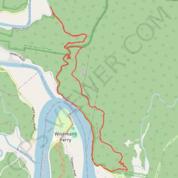
Interactive trail map

Trail profile

  • Distance: 8.9 mi
  • Elevation gain: 505 m
  • Maximum elevation: 204 m
  • Elevation loss: 506 m
  • Minimum elevation: 11 m

About this trail

Name: Shepherds Gully - Devines Hill - Finchs Line trail, distance, elevation, map, profile, GPS track

Start: Shepherds Gully Road, Lower Macdonald, Hawkesbury City Council, New South Wales, 2775, Australia (-33.35609 150.98324)

End: Settlers Road, Lower Macdonald, Hawkesbury City Council, New South Wales, 2775, Australia (-33.35487 150.98259)

Coordinates: -33.39333 150.98259 -33.35487 151.00419

Gear up for your next adventure:

Lightweight Tents - Compact tents for backpacking and trekking
🧴Tick Removal Tools - Small, essential health tool for UK woodland and moorland
👟Men's Trail Running Shoes - Lightweight grip for fast movement over topographic contours
🧰Survival Kits - Emergency tools for remote environments
📱Phone Mounts for Hiking - Secure mounts to carry your phone on trails

As an Amazon Associate, this site earns from qualifying purchases at no extra cost to you.