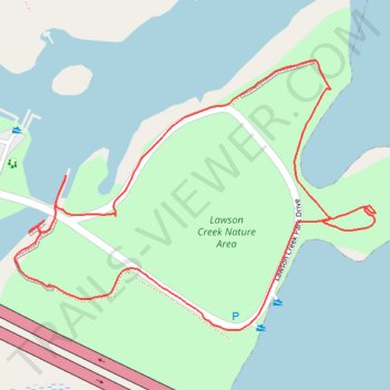
Lawson Creek Nature Area Loop
- Distance: 1.2 mi
- Elevation gain: 9 m
- Maximum elevation: 3 m
- Elevation loss: 10 m
- Minimum elevation: -4 m
- Moving time: 25 m 23 s
- Moving speed: 2.8 mph
- Maximum speed: 3.8 mph
- Total time: 25 m 23 s
- Global speed: 2.8 mph
Interactive trail map
Trail profile
- Distance: 1.2 mi
- Elevation gain: 9 m
- Maximum elevation: 3 m
- Elevation loss: 10 m
- Minimum elevation: -4 m
- Moving time: 25 m 23 s
- Moving speed: 2.8 mph
- Maximum speed: 3.8 mph
- Total time: 25 m 23 s
- Global speed: 2.8 mph
About this trail
Name: Lawson Creek Nature Area Loop trail, distance, elevation, map, profile, GPS track
Coordinates: 35.09901 -77.05254 35.10253 -77.04678