Make a donation
Gear up for your next adventure:
As an Amazon Associate, this site earns from qualifying purchases at no extra cost to you.
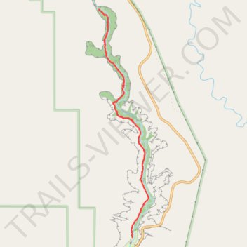
Lower Calf Creek Falls Trail in Grand Staircase-Escalante National Monument
The Lower Calf Creek Falls Trail in Grand Staircase-Escalante National Monument offers hikers a journey through high-walled canyons, verdant creekside vegetation, and historical artifacts. Along the path, one can observe ancient Fremont granaries and pictographs, as well as beaver dams and desert varnish on sandstone cliffs. The trail culminates at a striking 126-foot waterfall that plunges into a clear pool, providing a refreshing oasis in the desert. #Hiking #Mountain #Forest #Nature #Waterfall #River #Canyon #Cliff
- Distance: 5.9 mi
- Elevation gain: 443 m
- Maximum elevation: 1,737 m
- Elevation loss: 443 m
- Minimum elevation: 1,633 m
- Moving time: 2 h 51 m
- Moving speed: 2.1 mph
- Maximum speed: 3.9 mph
- Total time: 3 h 17 m
- Global speed: 1.8 mph
Interactive trail map
Make a donation
Gear up for your next adventure:
As an Amazon Associate, this site earns from qualifying purchases at no extra cost to you.
Trail profile
- Distance: 5.9 mi
- Elevation gain: 443 m
- Maximum elevation: 1,737 m
- Elevation loss: 443 m
- Minimum elevation: 1,633 m
- Moving time: 2 h 51 m
- Moving speed: 2.1 mph
- Maximum speed: 3.9 mph
- Total time: 3 h 17 m
- Global speed: 1.8 mph
Make a donation
Gear up for your next adventure:
As an Amazon Associate, this site earns from qualifying purchases at no extra cost to you.
About this trail
Name: Lower Calf Creek Falls Trail in Grand Staircase-Escalante National Monument trail, distance, elevation, map, profile, GPS track
End: Calf Creek Campground, UT 12, Boulder, Garfield County, Utah, United States (37.79513 -111.41368)
Coordinates: 37.79513 -111.41995 37.82896 -111.41064
Make a donation
Gear up for your next adventure:
As an Amazon Associate, this site earns from qualifying purchases at no extra cost to you.
Other hiking, mountain biking, running and outdoor activity trails
Click on a trail to view its statistics, map and profile.
Lower Calf Creek Falls Trail in Grand Staircase-Escalante National Monument
United States > Utah > Garfield County > Boulder
The Lower Calf Creek Falls Trail offers a captivating desert hike, leading you through a landscape of red sandstone walls and shaded creekside areas. Along the route, you'll encounter unique features such as ancient rock art and Fremont culture granaries, adding an intriguing historical dimension to the…
Distance: 6.5 mi • Elevation gain: 470 m • Maximum elevation: 1,736 m