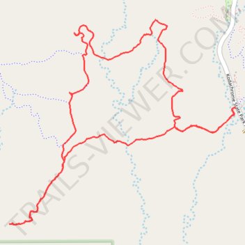
Panorama Loop Trail in Kodachrome Basin State Park
- Distance: 4.4 mi
- Elevation gain: 151 m
- Maximum elevation: 1,808 m
- Elevation loss: 151 m
- Minimum elevation: 1,757 m
- Moving time: 1 h 34 m
- Moving speed: 2.8 mph
- Maximum speed: 4.3 mph
- Total time: 1 h 53 m
- Global speed: 2.3 mph
Interactive trail map
Trail profile
- Distance: 4.4 mi
- Elevation gain: 151 m
- Maximum elevation: 1,808 m
- Elevation loss: 151 m
- Minimum elevation: 1,757 m
- Moving time: 1 h 34 m
- Moving speed: 2.8 mph
- Maximum speed: 4.3 mph
- Total time: 1 h 53 m
- Global speed: 2.3 mph
About this trail
Name: Panorama Loop Trail in Kodachrome Basin State Park trail, distance, elevation, map, profile, GPS track
Start: Panorama Trail, Kane County, Utah, 84736, United States (37.52252 -111.99202)
End: Panorama Trail, Kane County, Utah, 84736, United States (37.52254 -111.99205)
Coordinates: 37.51504 -112.01032 37.52815 -111.99202
Other hiking, mountain biking, running and outdoor activity trails
Click on a trail to view its statistics, map and profile.
Angels Palace Trail
United States > Utah > Kane County
Distance: 1.5 mi • Elevation gain: 80 m • Maximum elevation: 1,814 m