Cedar Valley Walk
Interactive trail map
Trail profile
- Distance: 0.8 mi
- Elevation gain: 16 m
- Maximum elevation: 149 m
- Elevation loss: 16 m
- Minimum elevation: 133 m
- Moving time: 19 m 59 s
- Moving speed: 2.4 mph
- Maximum speed: 3.8 mph
- Total time: 20 m 29 s
- Global speed: 2.3 mph
About this trail
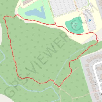
Name: Cedar Valley Walk trail, distance, elevation, map, profile, GPS track
Coordinates: 43.93787 -78.89834 43.94073 -78.89315
Other hiking, mountain biking, running and outdoor activity trails
Click on a trail to view its statistics, map and profile.
Scarborough - Cobourg
Lake Ontario. #Bike #Scarborough #Cobourg #Toronto #Ontario
Distance: 66.7 mi • Elevation gain: 717 m • Maximum elevation: 130 m