Riverside Park paths and Monster-T mountain bike trail
Afternoon Walk
- Distance: 1.6 mi
- Elevation gain: 51 m
- Maximum elevation: 110 m
- Elevation loss: 49 m
- Minimum elevation: 77 m
- Moving time: 39 m 48 s
- Moving speed: 2.4 mph
- Maximum speed: 4.1 mph
- Total time: 44 m 8 s
- Global speed: 2.2 mph
Interactive trail map
Trail profile
- Distance: 1.6 mi
- Elevation gain: 51 m
- Maximum elevation: 110 m
- Elevation loss: 49 m
- Minimum elevation: 77 m
- Moving time: 39 m 48 s
- Moving speed: 2.4 mph
- Maximum speed: 4.1 mph
- Total time: 44 m 8 s
- Global speed: 2.2 mph
About this trail
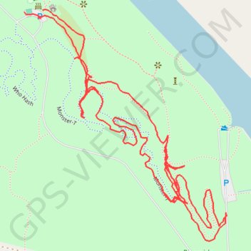
Name: Riverside Park paths and Monster-T mountain bike trail trail, distance, elevation, map, profile, GPS track
Start: Monster-T, White County, Arkansas, 72149, United States (35.28046 -91.71806)
End: Monster-T, White County, Arkansas, 72149, United States (35.28042 -91.71845)
Coordinates: 35.27648 -91.71845 35.28047 -91.71418