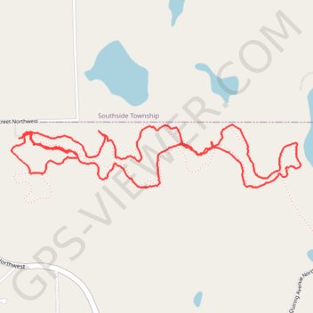
Stanley Eddy Trail
Wright County Running
- Distance: 3.6 mi
- Elevation gain: 50 m
- Maximum elevation: 349 m
- Elevation loss: 51 m
- Minimum elevation: 327 m
- Moving time: 55 m 14 s
- Moving speed: 3.9 mph
- Maximum speed: 10.6 mph
- Total time: 55 m 14 s
- Global speed: 3.9 mph
Interactive trail map
Trail profile
- Distance: 3.6 mi
- Elevation gain: 50 m
- Maximum elevation: 349 m
- Elevation loss: 51 m
- Minimum elevation: 327 m
- Moving time: 55 m 14 s
- Moving speed: 3.9 mph
- Maximum speed: 10.6 mph
- Total time: 55 m 14 s
- Global speed: 3.9 mph
About this trail
Name: Stanley Eddy Trail trail, distance, elevation, map, profile, GPS track
Coordinates: 45.23624 -94.24931 45.23915 -94.23031