Import a GPX file

Duchesnay Falls Loop

Lac Nipissing. #Hiking #Snowshoeing #Loop
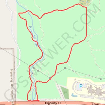
  • Distance: 2.2 mi
  • Elevation gain: 127 m
  • Maximum elevation: 316 m
  • Elevation loss: 127 m
  • Minimum elevation: 202 m

Interactive trail map

Trail profile

  • Distance: 2.2 mi
  • Elevation gain: 127 m
  • Maximum elevation: 316 m
  • Elevation loss: 127 m
  • Minimum elevation: 202 m

About this trail

Other hiking, mountain biking, running and outdoor activity trails

Click on a trail to view its statistics, map and profile.

West Nipissing - North Bay

Canada > Ontario > Nipissing District > Cache Bay

Lake Nipissing. #Bike #Nipissing #NorthBay

Distance: 28.9 mi • Elevation gain: 190 m • Maximum elevation: 238 m

Québec - Montréal - Saint-Laurent River - Lake Ontario - Niagara Falls

Canada > Quebec > Urban agglomeration of Québec > Quebec

#Bike #Ontario

Distance: 670.1 mi • Elevation gain: 4,804 m • Maximum elevation: 209 m

Gear up for your next adventure:

🗺️Topographic Maps - Detailed maps showing elevation and terrain features
❄️Walking Crampons - Added traction for icy slopes and winter peak bagging
Insulated Travel Mugs - Keep drinks hot while surveying the landscape from a summit
👖Convertible Hiking Trousers - Versatile zip-off pants for changing mountain weather conditions
🥄Titanium Camping Sporks - The ultimate lightweight utensil for trail meals

As an Amazon Associate, this site earns from qualifying purchases at no extra cost to you.