Whitecliffe Lakes Parkrun
- Distance: 3.2 mi
- Elevation gain: 115 m
- Maximum elevation: 24 m
- Elevation loss: 127 m
- Minimum elevation: -7 m
- Moving time: 30 m 43 s
- Moving speed: 6.2 mph
- Maximum speed: 8.8 mph
- Total time: 30 m 43 s
- Global speed: 6.2 mph
Interactive trail map
Trail profile
- Distance: 3.2 mi
- Elevation gain: 115 m
- Maximum elevation: 24 m
- Elevation loss: 127 m
- Minimum elevation: -7 m
- Moving time: 30 m 43 s
- Moving speed: 6.2 mph
- Maximum speed: 8.8 mph
- Total time: 30 m 43 s
- Global speed: 6.2 mph
About this trail
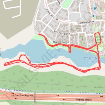
Name: Whitecliffe Lakes Parkrun trail, distance, elevation, map, profile, GPS track
Coordinates: 51.43183 0.29557 51.43403 0.30418
Topography: Kent topographic map, elevation, terrain