Eilat - Tzfahot - Yoash
הר צפחות ומצוקי גשרון: מעלות, מצוק, נחל, קניון ואספלט – המסלול הזה נותן הכל
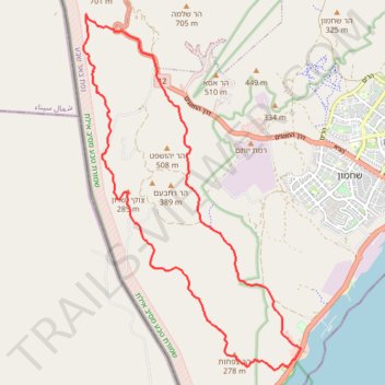
- Distance: 13.7 mi
- Elevation gain: 947 m
- Maximum elevation: 590 m
- Elevation loss: 948 m
- Minimum elevation: 7 m
- Moving time: 6 h 55 m
- Moving speed: 2.0 mph
- Maximum speed: 2.5 mph
- Total time: 6 h 55 m
- Global speed: 2.0 mph
Interactive trail map
Trail profile
- Distance: 13.7 mi
- Elevation gain: 947 m
- Maximum elevation: 590 m
- Elevation loss: 948 m
- Minimum elevation: 7 m
- Moving time: 6 h 55 m
- Moving speed: 2.0 mph
- Maximum speed: 2.5 mph
- Total time: 6 h 55 m
- Global speed: 2.0 mph
About this trail
Name: Eilat - Tzfahot - Yoash trail, distance, elevation, map, profile, GPS track
Start: 90, Eilat, Beersheba Subdistrict, South District, Israel (29.51055 34.92179)
End: 90, Eilat, Beersheba Subdistrict, South District, Israel (29.51051 34.92185)
Coordinates: 29.50994 34.87690 29.57840 34.92502
Other hiking, mountain biking, running and outdoor activity trails
Click on a trail to view its statistics, map and profile.
Bat Sheva, Shlomo and Rodad
Israel > South District > Eilat
בת שבע והר שלמה: מסלול באלף של אילת וסכין יותם
Distance: 12.3 mi • Elevation gain: 829 m • Maximum elevation: 678 m