Coastal Trail and Beach
- Distance: 1.5 mi
- Elevation gain: 39 m
- Maximum elevation: 59 m
- Elevation loss: 90 m
- Minimum elevation: 0 m
- Moving time: 36 m 38 s
- Moving speed: 2.4 mph
- Maximum speed: 4.9 mph
- Total time: 1 h 17 m
- Global speed: 1.1 mph
Interactive trail map
Trail profile
- Distance: 1.5 mi
- Elevation gain: 39 m
- Maximum elevation: 59 m
- Elevation loss: 90 m
- Minimum elevation: 0 m
- Moving time: 36 m 38 s
- Moving speed: 2.4 mph
- Maximum speed: 4.9 mph
- Total time: 1 h 17 m
- Global speed: 1.1 mph
About this trail
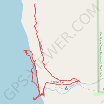
Name: Coastal Trail and Beach trail, distance, elevation, map, profile, GPS track
Start: Coastal Trail, Del Norte County, California, United States (41.70557 -124.14269)
End: Coastal Trail, Del Norte County, California, United States (41.70028 -124.14196)
Coordinates: 41.69953 -124.14361 41.70557 -124.13886
Other hiking, mountain biking, running and outdoor activity trails
Click on a trail to view its statistics, map and profile.
Coastal Trail
United States > California > Del Norte County
Distance: 0.7 mi • Elevation gain: 60 m • Maximum elevation: 58 m