Sydney - Kogarah
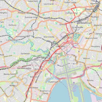
Interactive trail map
Trail profile
- Distance: 8.6 mi
- Elevation gain: 122 m
- Maximum elevation: 47 m
- Elevation loss: 119 m
- Minimum elevation: -3 m
About this trail
Name: Sydney - Kogarah trail, distance, elevation, map, profile, GPS track
Coordinates: -33.96342 151.13206 -33.88189 151.18448
Other hiking, mountain biking, running and outdoor activity trails
Click on a trail to view its statistics, map and profile.
Sydney Loop Ride via Homebush Bay, Powells Creek, Hudson Park, Cooks River Cycleway, Cooks to Cove Greenway, Hawthorne Canal and Iron Cove
Australia > New South Wales > Sydney
Distance: 33.9 mi • Elevation gain: 343 m • Maximum elevation: 34 m
Bicycle ride from Maroubra to Loftus
Australia > New South Wales > Sydney
Distance: 21.0 mi • Elevation gain: 276 m • Maximum elevation: 112 m
Sydney to Oran Park NSW
Australia > New South Wales > Sydney
Distance: 37.5 mi • Elevation gain: 577 m • Maximum elevation: 126 m