Cleghorn Mountain
Hike to Cleghorn Mountain via Cleghorn Ridge Trail in San Bernardino National Forest. #Hiking #Mountain #Nature #Forest
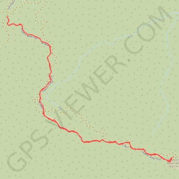
- Distance: 5.7 mi
- Elevation gain: 453 m
- Maximum elevation: 1,621 m
- Elevation loss: 452 m
- Minimum elevation: 1,197 m
- Moving time: 3 h 6 m
- Moving speed: 1.8 mph
- Maximum speed: 3.7 mph
- Total time: 4 h 22 m
- Global speed: 1.3 mph
Interactive trail map
Trail profile
- Distance: 5.7 mi
- Elevation gain: 453 m
- Maximum elevation: 1,621 m
- Elevation loss: 452 m
- Minimum elevation: 1,197 m
- Moving time: 3 h 6 m
- Moving speed: 1.8 mph
- Maximum speed: 3.7 mph
- Total time: 4 h 22 m
- Global speed: 1.3 mph
About this trail
Name: Cleghorn Mountain trail, distance, elevation, map, profile, GPS track
Start: Cleghorn Ridge Trail, San Bernardino County, California, United States (34.31220 -117.43819)
End: Cleghorn Ridge Trail, San Bernardino County, California, United States (34.31218 -117.43814)
Coordinates: 34.29345 -117.43819 34.31220 -117.41238
Other hiking, mountain biking, running and outdoor activity trails
Click on a trail to view its statistics, map and profile.