Import a GPX file

Tin Mine Canyon

Hike along the Tin Mine Canyon in the Cleveland National Forest. #Hiking #Canyon #River #Forest #Nature

  • Distance: 2.2 mi
  • Elevation gain: 232 m
  • Maximum elevation: 543 m
  • Elevation loss: 18 m
  • Minimum elevation: 329 m

Interactive trail map

Trail profile

  • Distance: 2.2 mi
  • Elevation gain: 232 m
  • Maximum elevation: 543 m
  • Elevation loss: 18 m
  • Minimum elevation: 329 m

About this trail

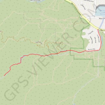
Name: Tin Mine Canyon trail, distance, elevation, map, profile, GPS track

Start: Skyline Drive, Corona, Riverside County, California, 92882, United States (33.84199 -117.59836)

End: Troy Lee Trail, Riverside County, California, 92882, United States (33.83107 -117.62487)

Coordinates: 33.83107 -117.62487 33.84199 -117.59748

Gear up for your next adventure:

🧤Waterproof Overmitts - Extreme weather protection for hikers and mountaineers
🥾Men's Waterproof Hiking Boots - Durable footwear with deep lugs for muddy and rocky UK terrains
🧺Microfibre Travel Towels - Fast-drying and compact towels for wild swimming and camping
📚UK Hiking Guidebooks - Detailed route descriptions for the Lake District, Peaks, and Highlands
🚲Bikepacking Frame Bags - Storage for tools and navigation gear on long off-road rides

As an Amazon Associate, this site earns from qualifying purchases at no extra cost to you.