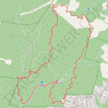
Belmont Trig Loop Walk
- Distance: 6.9 mi
- Elevation gain: 609 m
- Maximum elevation: 446 m
- Elevation loss: 610 m
- Minimum elevation: 62 m
- Moving time: 2 h 34 m
- Moving speed: 2.7 mph
- Maximum speed: 4.9 mph
- Total time: 3 h 19 m
- Global speed: 2.1 mph
Interactive trail map
Trail profile
- Distance: 6.9 mi
- Elevation gain: 609 m
- Maximum elevation: 446 m
- Elevation loss: 610 m
- Minimum elevation: 62 m
- Moving time: 2 h 34 m
- Moving speed: 2.7 mph
- Maximum speed: 4.9 mph
- Total time: 3 h 19 m
- Global speed: 2.1 mph
About this trail
Name: Belmont Trig Loop Walk trail, distance, elevation, map, profile, GPS track
Coordinates: -41.20238 174.86309 -41.18170 174.88363
Other hiking, mountain biking, running and outdoor activity trails
Click on a trail to view its statistics, map and profile.
Belmont and Cannons Head Loop Walk
New Zealand > Wellington > Lower Hutt City > Lower Hutt
Distance: 6.6 mi • Elevation gain: 514 m • Maximum elevation: 446 m
Korokoro Dam
New Zealand > Wellington > Lower Hutt City > Lower Hutt
Walking
Distance: 1.8 mi • Elevation gain: 156 m • Maximum elevation: 201 m