Wintergreen Loop
- Distance: 2.7 mi
- Elevation gain: 243 m
- Maximum elevation: 1,002 m
- Elevation loss: 246 m
- Minimum elevation: 795 m
- Moving time: 1 h 37 m
- Moving speed: 1.6 mph
- Maximum speed: 4.5 mph
- Total time: 1 h 49 m
- Global speed: 1.5 mph
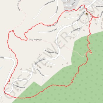
Interactive trail map
Trail profile
- Distance: 2.7 mi
- Elevation gain: 243 m
- Maximum elevation: 1,002 m
- Elevation loss: 246 m
- Minimum elevation: 795 m
- Moving time: 1 h 37 m
- Moving speed: 1.6 mph
- Maximum speed: 4.5 mph
- Total time: 1 h 49 m
- Global speed: 1.5 mph
About this trail
Name: Wintergreen Loop trail, distance, elevation, map, profile, GPS track
Start: 711, Laurelwood, Wintergreen, Nelson County, Virginia, 22967, United States (37.91246 -78.94433)
End: Laurel Ridge Loop, Wintergreen, Nelson County, Virginia, 22958, United States (37.91237 -78.94472)
Coordinates: 37.90442 -78.95626 37.91363 -78.94433