Make a donation
Gear up for your next adventure:
As an Amazon Associate, this site earns from qualifying purchases at no extra cost to you.
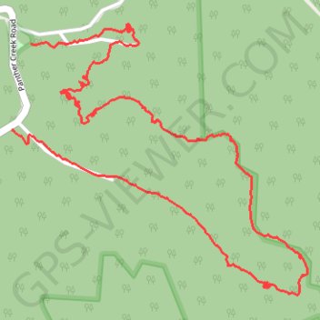
Loop Trail - Panther State Forest
Hiking, trail
- Distance: 3.8 mi
- Elevation gain: 331 m
- Maximum elevation: 588 m
- Elevation loss: 329 m
- Minimum elevation: 352 m
- Moving time: 13 m 41 s
- Moving speed: 16.6 mph
- Maximum speed: 28.5 mph
- Total time: 13 m 41 s
- Global speed: 16.6 mph
Interactive trail map
Make a donation
Gear up for your next adventure:
As an Amazon Associate, this site earns from qualifying purchases at no extra cost to you.
Trail profile
- Distance: 3.8 mi
- Elevation gain: 331 m
- Maximum elevation: 588 m
- Elevation loss: 329 m
- Minimum elevation: 352 m
- Moving time: 13 m 41 s
- Moving speed: 16.6 mph
- Maximum speed: 28.5 mph
- Total time: 13 m 41 s
- Global speed: 16.6 mph
Make a donation
Gear up for your next adventure:
As an Amazon Associate, this site earns from qualifying purchases at no extra cost to you.
About this trail
Name: Loop Trail - Panther State Forest trail, distance, elevation, map, profile, GPS track
Start: Buzzards Roost Overlook Trail, McDowell County, West Virginia, United States (37.42812 -81.86012)
End: Panther Creek Road, McDowell County, West Virginia, 24872, United States (37.42477 -81.86116)
Coordinates: 37.41832 -81.86116 37.42890 -81.84661
Make a donation
Gear up for your next adventure:
As an Amazon Associate, this site earns from qualifying purchases at no extra cost to you.
Other hiking, mountain biking, running and outdoor activity trails
Click on a trail to view its statistics, map and profile.
Loop Trail - Panther Wildlife Management Area
United States > West Virginia > McDowell County
Hiking, trail
Distance: 3.8 mi • Elevation gain: 334 m • Maximum elevation: 588 m