Parcour Herbignac ferel 20/11/22
- Distance: 11.7 mi
- Elevation gain: 214 m
- Maximum elevation: 44 m
- Elevation loss: 215 m
- Minimum elevation: 3 m
- Moving time: 2 h 34 m
- Moving speed: 4.5 mph
- Maximum speed: 31.3 mph
- Total time: 2 h 41 m
- Global speed: 4.3 mph
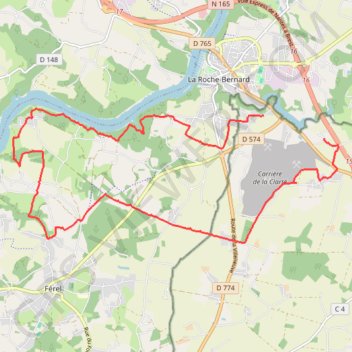
Interactive trail map
Trail profile
- Distance: 11.7 mi
- Elevation gain: 214 m
- Maximum elevation: 44 m
- Elevation loss: 215 m
- Minimum elevation: 3 m
- Moving time: 2 h 34 m
- Moving speed: 4.5 mph
- Maximum speed: 31.3 mph
- Total time: 2 h 41 m
- Global speed: 4.3 mph
About this trail
Name: Parcour Herbignac ferel 20/11/22 trail, distance, elevation, map, profile, GPS track
Coordinates: 47.49019 -2.35393 47.51335 -2.27091