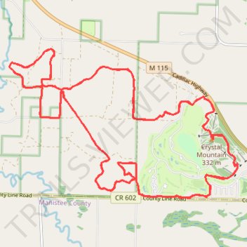
Peak 2 Peak MTB race
- Distance: 25.6 mi
- Elevation gain: 354 m
- Maximum elevation: 340 m
- Elevation loss: 353 m
- Minimum elevation: 216 m
- Moving time: 1 h 52 m
- Moving speed: 13.6 mph
- Maximum speed: 22.8 mph
- Total time: 1 h 52 m
- Global speed: 13.6 mph
Interactive trail map
Trail profile
- Distance: 25.6 mi
- Elevation gain: 354 m
- Maximum elevation: 340 m
- Elevation loss: 353 m
- Minimum elevation: 216 m
- Moving time: 1 h 52 m
- Moving speed: 13.6 mph
- Maximum speed: 22.8 mph
- Total time: 1 h 52 m
- Global speed: 13.6 mph
About this trail
Name: Peak 2 Peak MTB race trail, distance, elevation, map, profile, GPS track
Coordinates: 44.51397 -86.05279 44.54171 -85.99303