Stony Hill Creek and Melton loop
- Distance: 8.1 mi
- Elevation gain: 59 m
- Maximum elevation: 135 m
- Elevation loss: 59 m
- Minimum elevation: 91 m
- Moving time: 43 m 8 s
- Moving speed: 11.3 mph
- Maximum speed: 18.9 mph
- Total time: 57 m 4 s
- Global speed: 8.5 mph
Interactive trail map
Trail profile
- Distance: 8.1 mi
- Elevation gain: 59 m
- Maximum elevation: 135 m
- Elevation loss: 59 m
- Minimum elevation: 91 m
- Moving time: 43 m 8 s
- Moving speed: 11.3 mph
- Maximum speed: 18.9 mph
- Total time: 57 m 4 s
- Global speed: 8.5 mph
About this trail
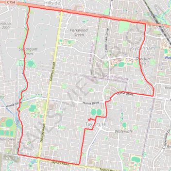
Name: Stony Hill Creek and Melton loop trail, distance, elevation, map, profile, GPS track
Coordinates: -37.72357 144.73285 -37.69126 144.76800