
Veit Spring Trail
- Distance: 1.4 mi
- Elevation gain: 50 m
- Maximum elevation: 2,632 m
- Elevation loss: 63 m
- Minimum elevation: 2,582 m
- Moving time: 22 m 42 s
- Moving speed: 3.7 mph
- Maximum speed: 7.0 mph
- Total time: 22 m 42 s
- Global speed: 3.7 mph
Interactive trail map
Trail profile
- Distance: 1.4 mi
- Elevation gain: 50 m
- Maximum elevation: 2,632 m
- Elevation loss: 63 m
- Minimum elevation: 2,582 m
- Moving time: 22 m 42 s
- Moving speed: 3.7 mph
- Maximum speed: 7.0 mph
- Total time: 22 m 42 s
- Global speed: 3.7 mph
About this trail
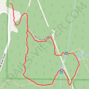
Name: Veit Spring Trail trail, distance, elevation, map, profile, GPS track
Start: Veit Spring Trail, Coconino County, Arizona, 86001, United States (35.30985 -111.71908)
End: Veit Spring Trail, Coconino County, Arizona, 86001, United States (35.30800 -111.71762)
Coordinates: 35.30415 -111.71908 35.30986 -111.71316