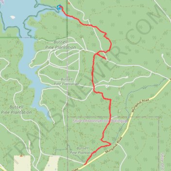
Wilman Bilya trail collie near South east side
- Distance: 13.7 mi
- Elevation gain: 436 m
- Maximum elevation: 274 m
- Elevation loss: 435 m
- Minimum elevation: 172 m
- Moving time: 3 h 3 m
- Moving speed: 4.5 mph
- Maximum speed: 8.0 mph
- Total time: 3 h 9 m
- Global speed: 4.3 mph
Interactive trail map
Trail profile
- Distance: 13.7 mi
- Elevation gain: 436 m
- Maximum elevation: 274 m
- Elevation loss: 435 m
- Minimum elevation: 172 m
- Moving time: 3 h 3 m
- Moving speed: 4.5 mph
- Maximum speed: 8.0 mph
- Total time: 3 h 9 m
- Global speed: 4.3 mph
About this trail
Name: Wilman Bilya trail collie near South east side trail, distance, elevation, map, profile, GPS track
Start: Kelly Road, Mungalup, Shire Of Collie, Western Australia, Australia (-33.41988 116.04110)
End: Kelly Road, Mungalup, Shire Of Collie, Western Australia, Australia (-33.41996 116.04127)
Coordinates: -33.45988 116.02027 -33.39998 116.04362
Other hiking, mountain biking, running and outdoor activity trails
Click on a trail to view its statistics, map and profile.
Wilman Bilya trail collie near Wellington dam south side
Australia > Western Australia > Yabberup
Distance: 17.6 mi • Elevation gain: 533 m • Maximum elevation: 297 m
Wiilman Bilya Trail Connell Road Area
Australia > Western Australia > Mungalup
Distance: 12.0 mi • Elevation gain: 450 m • Maximum elevation: 262 m