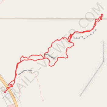
Walatowa Bench Trail, Red Rocks Trail and Slot Canyon hike
- Distance: 1.9 mi
- Elevation gain: 98 m
- Maximum elevation: 1,789 m
- Elevation loss: 98 m
- Minimum elevation: 1,713 m
- Moving time: 1 h 9 m
- Moving speed: 1.7 mph
- Maximum speed: 5.1 mph
- Total time: 1 h 30 m
- Global speed: 1.3 mph
Interactive trail map
Trail profile
- Distance: 1.9 mi
- Elevation gain: 98 m
- Maximum elevation: 1,789 m
- Elevation loss: 98 m
- Minimum elevation: 1,713 m
- Moving time: 1 h 9 m
- Moving speed: 1.7 mph
- Maximum speed: 5.1 mph
- Total time: 1 h 30 m
- Global speed: 1.3 mph
About this trail
Name: Walatowa Bench Trail, Red Rocks Trail and Slot Canyon hike trail, distance, elevation, map, profile, GPS track
Start: NM 4, Sandoval County, New Mexico, 87024, United States (35.64488 -106.72597)
End: NM 4, Sandoval County, New Mexico, 87024, United States (35.64486 -106.72604)
Coordinates: 35.64485 -106.72607 35.65040 -106.71750