Big Tree road area MTB ride
Fantastic Mountain Bike Ride
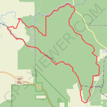
- Distance: 25.1 mi
- Elevation gain: 645 m
- Maximum elevation: 281 m
- Elevation loss: 645 m
- Minimum elevation: 78 m
- Moving time: 3 h 11 m
- Moving speed: 7.9 mph
- Maximum speed: 29.8 mph
- Total time: 4 h 17 m
- Global speed: 5.9 mph
Interactive trail map
Trail profile
- Distance: 25.1 mi
- Elevation gain: 645 m
- Maximum elevation: 281 m
- Elevation loss: 645 m
- Minimum elevation: 78 m
- Moving time: 3 h 11 m
- Moving speed: 7.9 mph
- Maximum speed: 29.8 mph
- Total time: 4 h 17 m
- Global speed: 5.9 mph
About this trail
Name: Big Tree road area MTB ride trail, distance, elevation, map, profile, GPS track
Coordinates: -33.30794 115.91386 -33.21110 116.02153
Other hiking, mountain biking, running and outdoor activity trails
Click on a trail to view its statistics, map and profile.
Martins Rock Lookout Loop in the Wellington National Park
Mountain Bike Ride in the Wilderness
Distance: 13.9 mi • Elevation gain: 362 m • Maximum elevation: 282 m
Herman road loop - New section of Mundabiddi trail
Morning Mountain Bike Ride
Distance: 18.4 mi • Elevation gain: 387 m • Maximum elevation: 283 m
Worsley railway line area Mountain Bike Ride
Australia > Western Australia > Worsley
Distance: 15.7 mi • Elevation gain: 357 m • Maximum elevation: 266 m
Mornington Road area Mountain Bike Ride
Australia > Western Australia > Worsley
Distance: 17.3 mi • Elevation gain: 324 m • Maximum elevation: 280 m