Import a GPX file

Ride to Deepwater Point Park via Traverse Area Recreational Trail

  • Distance: 16.4 mi
  • Elevation gain: 139 m
  • Maximum elevation: 201 m
  • Elevation loss: 139 m
  • Minimum elevation: 174 m
  • Moving time: 2 h 1 m
  • Moving speed: 8.1 mph
  • Maximum speed: 17.7 mph
  • Total time: 2 h 23 m
  • Global speed: 6.9 mph

Interactive trail map

Trail profile

  • Distance: 16.4 mi
  • Elevation gain: 139 m
  • Maximum elevation: 201 m
  • Elevation loss: 139 m
  • Minimum elevation: 174 m
  • Moving time: 2 h 1 m
  • Moving speed: 8.1 mph
  • Maximum speed: 17.7 mph
  • Total time: 2 h 23 m
  • Global speed: 6.9 mph

About this trail

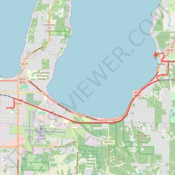
Name: Ride to Deepwater Point Park via Traverse Area Recreational Trail trail, distance, elevation, map, profile, GPS track

Start: 850, Centre Street, Traverse Heights, Traverse City, Grand Traverse County, Michigan, 49686, United States (44.75143 -85.60281)

End: 854, Centre Street, Traverse Heights, Traverse City, Grand Traverse County, Michigan, 49686, United States (44.75118 -85.60267)

Coordinates: 44.74453 -85.60281 44.77745 -85.49633

Gear up for your next adventure:

🎒Multi-day Trekking Packs - Large capacity backpacks for wild camping and long-distance trails
🧤Waterproof Overmitts - Extreme weather protection for hikers and mountaineers
Altimeter Watches - Watches measuring altitude for mountain activities
🎒Backpack Rain Covers - Universal waterproof covers to protect your gear from downpours
📕Outdoor Navigation Books - Learn traditional and modern navigation techniques

As an Amazon Associate, this site earns from qualifying purchases at no extra cost to you.