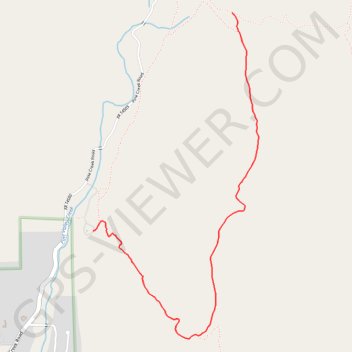
Import a GPX file

Noble Canyon

Hike on the Noble Canyon Trail in the Cleveland National Forest. #Hiking #Mountain #Nature #Forest #Canyon

  • Distance: 2.7 mi
  • Elevation gain: 126 m
  • Maximum elevation: 1,285 m
  • Elevation loss: 161 m
  • Minimum elevation: 1,130 m

Interactive trail map

Trail profile

  • Distance: 2.7 mi
  • Elevation gain: 126 m
  • Maximum elevation: 1,285 m
  • Elevation loss: 161 m
  • Minimum elevation: 1,130 m

About this trail

Name: Noble Canyon trail, distance, elevation, map, profile, GPS track

Start: Noble Canyon Trail, San Diego County, California, 91962, United States (32.86472 -116.51142)

End: Noble Canyon Trail, San Diego County, California, 91962, United States (32.84975 -116.52278)

Coordinates: 32.84230 -116.52278 32.86472 -116.50923

Gear up for your next adventure:

📕Outdoor Navigation Books - Learn traditional and modern navigation techniques
📦Dry Bags - Waterproof bags to protect gear from rain
🎿Telescopic Trekking Poles - Reduces knee strain on steep topographic descents
🧭Professional Hiking Compasses - High-precision liquid-filled compasses for map reading and orientation
🩹Hiking First Aid Kits - Compact medical kits tailored for trail injuries and emergencies

As an Amazon Associate, this site earns from qualifying purchases at no extra cost to you.