To the pool and back by the new greenway
Junction of LSC and Little Hope Creek Greenways
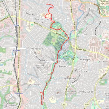
- Distance: 9.0 mi
- Elevation gain: 171 m
- Maximum elevation: 212 m
- Elevation loss: 171 m
- Minimum elevation: 171 m
- Moving time: 1 h 6 s
- Moving speed: 9.0 mph
- Maximum speed: 18.7 mph
- Total time: 3 h 43 m
- Global speed: 2.4 mph
Interactive trail map
Trail profile
- Distance: 9.0 mi
- Elevation gain: 171 m
- Maximum elevation: 212 m
- Elevation loss: 171 m
- Minimum elevation: 171 m
- Moving time: 1 h 6 s
- Moving speed: 9.0 mph
- Maximum speed: 18.7 mph
- Total time: 3 h 43 m
- Global speed: 2.4 mph
About this trail
Name: To the pool and back by the new greenway trail, distance, elevation, map, profile, GPS track
Coordinates: 35.13011 -80.86581 35.17047 -80.85192