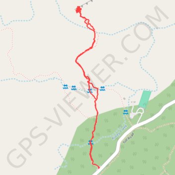
Pinnacles shooting gallery approach
- Distance: 1.9 mi
- Elevation gain: 119 m
- Maximum elevation: 1,492 m
- Elevation loss: 114 m
- Minimum elevation: 1,445 m
- Moving time: 49 m 44 s
- Moving speed: 2.3 mph
- Maximum speed: 9.1 mph
- Total time: 4 h 3 m
- Global speed: 0.5 mph
Interactive trail map
Trail profile
- Distance: 1.9 mi
- Elevation gain: 119 m
- Maximum elevation: 1,492 m
- Elevation loss: 114 m
- Minimum elevation: 1,445 m
- Moving time: 49 m 44 s
- Moving speed: 2.3 mph
- Maximum speed: 9.1 mph
- Total time: 4 h 3 m
- Global speed: 0.5 mph
About this trail
Name: Pinnacles shooting gallery approach trail, distance, elevation, map, profile, GPS track
Start: CA 173, San Bernardino County, California, 92352, United States (34.29457 -117.21367)
End: CA 173, San Bernardino County, California, 92352, United States (34.29419 -117.21326)
Coordinates: 34.29419 -117.21460 34.30187 -117.21324
Other hiking, mountain biking, running and outdoor activity trails
Click on a trail to view its statistics, map and profile.