Import a GPX file

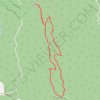
Tanglefoot Trails of Toolangi

  • Distance: 9.7 mi
  • Elevation gain: 580 m
  • Maximum elevation: 925 m
  • Elevation loss: 589 m
  • Minimum elevation: 627 m

Interactive trail map

Trail profile

  • Distance: 9.7 mi
  • Elevation gain: 580 m
  • Maximum elevation: 925 m
  • Elevation loss: 589 m
  • Minimum elevation: 627 m

About this trail

Name: Tanglefoot Trails of Toolangi trail, distance, elevation, map, profile, GPS track

Start: Tanglefoot Loop, Toolangi, Shire of Murrindindi, Victoria, 3777, Australia (-37.52780 145.52196)

End: Wirrawilla Rainforest Walk, Toolangi, Shire of Murrindindi, Victoria, 3777, Australia (-37.52764 145.52151)

Coordinates: -37.55702 145.51891 -37.50762 145.53283

Other hiking, mountain biking, running and outdoor activity trails

Click on a trail to view its statistics, map and profile.

Tallarook - Eildon - Hurstbridge

Australia > Victoria > Tallarook

#Bike

Distance: 173.2 mi • Elevation gain: 4,897 m • Maximum elevation: 868 m
Wirrawilla - Mount Saint Leonard

Australia > Victoria > Melbourne

Toolangi State Forest. Yarra Ranges National Park. #Hiking #Loop #Toolangi #Yarra

Distance: 8.1 mi • Elevation gain: 511 m • Maximum elevation: 1,013 m

Tanglefoot Loop

Australia > Victoria

Yarra Ranges National Park. #Hiking #Loop #Yarra

Distance: 5.5 mi • Elevation gain: 338 m • Maximum elevation: 925 m

Gear up for your next adventure:

🥾Hiking Boot Waterproofing Wax - Maintain the lifespan of your leather trekking boots
🛑Emergency Bivvy Bags - Heat-reflective survival bags for unexpected nights out
🔋Solar Power Banks - Keep your GPS and phone charged during multi-day expeditions
🪓Outdoor Multitools - Versatile tools for hiking and camping
🥤Hydration Bladders - Hands-free hydration systems for backpacks

As an Amazon Associate, this site earns from qualifying purchases at no extra cost to you.