Import a GPX file

Mesa to Tempe Town Lake via stadium connector path

  • Distance: 8.8 mi
  • Elevation gain: 44 m
  • Maximum elevation: 388 m
  • Elevation loss: 76 m
  • Minimum elevation: 347 m

Interactive trail map

Trail profile

  • Distance: 8.8 mi
  • Elevation gain: 44 m
  • Maximum elevation: 388 m
  • Elevation loss: 76 m
  • Minimum elevation: 347 m

About this trail
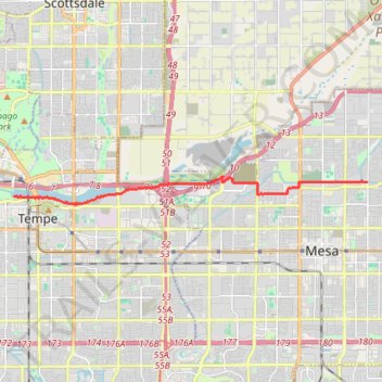
Name: Mesa to Tempe Town Lake via stadium connector path trail, distance, elevation, map, profile, GPS track

Start: Sun Circle Trail, Hohokam Village, Mesa, Maricopa County, Arizona, 85203, United States (33.43699 -111.81413)

End: Elmore Pedestrian Bridge, Tempe, Maricopa County, Arizona, 85281, United States (33.43242 -111.94890)

Coordinates: 33.42979 -111.94893 33.43870 -111.81413

Gear up for your next adventure:

🧭Professional Hiking Compasses - High-precision liquid-filled compasses for map reading and orientation
Lightweight Solo Tents - Backpacking tents designed for wild camping in the UK highlands
🔋Rechargeable Batteries - Eco-friendly power for headlamps and older GPS units
🧴Sport Sunscreen Sticks - High-protection sunblock that won't run into your eyes on the trail
🧥Waterproof Hiking Jackets - Rain protection for walking in all weather conditions

As an Amazon Associate, this site earns from qualifying purchases at no extra cost to you.