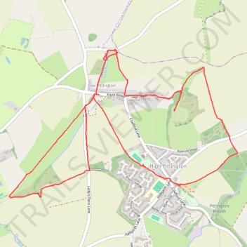
High and low Pitington loop
- Distance: 4.2 mi
- Elevation gain: 110 m
- Maximum elevation: 156 m
- Elevation loss: 111 m
- Minimum elevation: 72 m
- Moving time: 1 h 35 m
- Moving speed: 2.6 mph
- Maximum speed: 5.8 mph
- Total time: 1 h 49 m
- Global speed: 2.3 mph
Interactive trail map
Trail profile
- Distance: 4.2 mi
- Elevation gain: 110 m
- Maximum elevation: 156 m
- Elevation loss: 111 m
- Minimum elevation: 72 m
- Moving time: 1 h 35 m
- Moving speed: 2.6 mph
- Maximum speed: 5.8 mph
- Total time: 1 h 49 m
- Global speed: 2.3 mph
About this trail
Name: High and low Pitington loop trail, distance, elevation, map, profile, GPS track
Coordinates: 54.79030 -1.50616 54.80017 -1.47980
Topography: County Durham topographic map, elevation, terrain