Import a GPX file

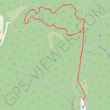
The Spine - Button's Fail

#Hiking #MTB #Loop

  • Distance: 1.8 mi
  • Elevation gain: 47 m
  • Maximum elevation: 325 m
  • Elevation loss: 47 m
  • Minimum elevation: 291 m

Interactive trail map

Trail profile

  • Distance: 1.8 mi
  • Elevation gain: 47 m
  • Maximum elevation: 325 m
  • Elevation loss: 47 m
  • Minimum elevation: 291 m

About this trail

Other hiking, mountain biking, running and outdoor activity trails

Click on a trail to view its statistics, map and profile.

Jarrahdale - Munda Biddi Trail

Australia > Western Australia > Jarrahdale

#MTB #Loop

Distance: 36.3 mi • Elevation gain: 577 m • Maximum elevation: 348 m

Gear up for your next adventure:

🌦️Portable Weather Meters - Handheld tools for monitoring weather conditions
🥾Hiking Boot Waterproofing Wax - Maintain the lifespan of your leather trekking boots
👕Merino Base Layers - Natural temperature regulation for cold weather hiking and camping
🛰️Satellite Messengers - Emergency communication devices for areas without mobile signal
🛌Insulated Sleeping Mats - Crucial thermal protection when sleeping on cold, uneven ground

As an Amazon Associate, this site earns from qualifying purchases at no extra cost to you.