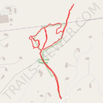
Grossman Preserve trails
- Distance: 1.6 mi
- Elevation gain: 75 m
- Maximum elevation: 147 m
- Elevation loss: 75 m
- Minimum elevation: 116 m
- Moving time: 35 m 16 s
- Moving speed: 2.8 mph
- Maximum speed: 6.0 mph
- Total time: 36 m 25 s
- Global speed: 2.7 mph
Interactive trail map
Trail profile
- Distance: 1.6 mi
- Elevation gain: 75 m
- Maximum elevation: 147 m
- Elevation loss: 75 m
- Minimum elevation: 116 m
- Moving time: 35 m 16 s
- Moving speed: 2.8 mph
- Maximum speed: 6.0 mph
- Total time: 36 m 25 s
- Global speed: 2.7 mph
About this trail
Name: Grossman Preserve trails trail, distance, elevation, map, profile, GPS track
Coordinates: 41.30443 -73.60564 41.31059 -73.60182
Other hiking, mountain biking, running and outdoor activity trails
Click on a trail to view its statistics, map and profile.