Import a GPX file

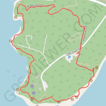
Amphitrite Point Lighthouse Loop

Wild Pacific Trail. Vancouver Island. #Hiking #Running #Loop #Vancouver

  • Distance: 1.6 mi
  • Elevation gain: 52 m
  • Maximum elevation: 26 m
  • Elevation loss: 52 m
  • Minimum elevation: 1 m

Interactive trail map

Trail profile

  • Distance: 1.6 mi
  • Elevation gain: 52 m
  • Maximum elevation: 26 m
  • Elevation loss: 52 m
  • Minimum elevation: 1 m

About this trail
Gear up for your next adventure:

📻Hand-Crank Emergency Radios - Stay updated on weather warnings in remote areas
🥤Hydration Bladders - Hands-free hydration systems for backpacks
🗺️Topographic Maps - Detailed maps showing elevation and terrain features
🧤Hiking Gloves - Warm and durable gloves for cold-weather walks
🔋Rechargeable Batteries - Eco-friendly power for headlamps and older GPS units

As an Amazon Associate, this site earns from qualifying purchases at no extra cost to you.