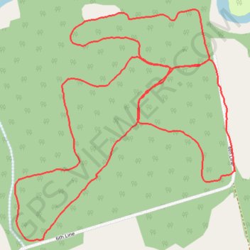
Simcoe County Forest - Foster Tract
Interactive trail map
Trail profile
- Distance: 2.4 mi
- Elevation gain: 17 m
- Maximum elevation: 228 m
- Elevation loss: 17 m
- Minimum elevation: 218 m
About this trail
Name: Simcoe County Forest - Foster Tract trail, distance, elevation, map, profile, GPS track
Start: 7493, 6th Line, Essa, Simcoe County, Central Ontario, Ontario, L0L 1N0, Canada (44.27255 -79.82320)
End: 7493, 6th Line, Essa, Simcoe County, Central Ontario, Ontario, L0L 1N0, Canada (44.27256 -79.82314)
Coordinates: 44.27069 -79.83142 44.27692 -79.82314
Other hiking, mountain biking, running and outdoor activity trails
Click on a trail to view its statistics, map and profile.
Ontario country roads
Distance: 93.4 mi • Elevation gain: 1,137 m • Maximum elevation: 497 m