High Rock Lookout
Interactive trail map
Trail profile
- Distance: 3.3 mi
- Elevation gain: 495 m
- Maximum elevation: 1,702 m
- Elevation loss: 495 m
- Minimum elevation: 1,295 m
About this trail
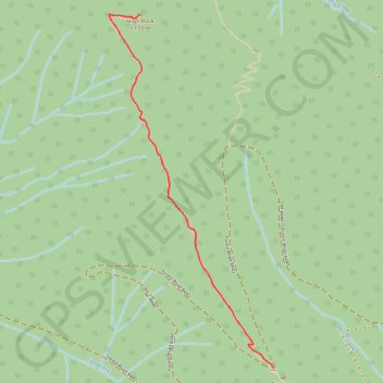
Name: High Rock Lookout trail, distance, elevation, map, profile, GPS track
Start: Forest Road 8440, Lewis County, Washington, United States (46.66651 -121.89144)
End: Forest Road 8440, Lewis County, Washington, United States (46.66651 -121.89144)
Coordinates: 46.66651 -121.90357 46.68446 -121.89144
Other hiking, mountain biking, running and outdoor activity trails
Click on a trail to view its statistics, map and profile.
Northern part of the Pacific Crest Trail (PCT)
United States > Oregon > Klamath County
Hike on the Pacific Crest National Scenic Trail from Crater Lake to Canada Border through Oregon and Washington along the Sierra Nevada and Cascade mountain ranges. #Hiking #Mountain #SierraNevada #Cascade #Nature #Forest #Park #PCT
Distance: 744.6 mi • Elevation gain: 44,308 m • Maximum elevation: 2,307 m