Bouillon-9k
name=Bouillon-9k
- Distance: 5.6 mi
- Elevation gain: 357 m
- Maximum elevation: 364 m
- Elevation loss: 356 m
- Minimum elevation: 212 m
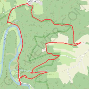
Interactive trail map
Trail profile
- Distance: 5.6 mi
- Elevation gain: 357 m
- Maximum elevation: 364 m
- Elevation loss: 356 m
- Minimum elevation: 212 m
About this trail
Name: Bouillon-9k trail, distance, elevation, map, profile, GPS track
Start: L'Epine, Sensenruth, Bouillon, Neufchâteau, Luxembourg, Wallonia, 6832, Belgium (49.80447 5.04487)
End: L'Epine, Sensenruth, Bouillon, Neufchâteau, Luxembourg, Wallonia, 6832, Belgium (49.80442 5.04501)
Coordinates: 49.80324 5.04106 49.82196 5.06695
Other hiking, mountain biking, running and outdoor activity trails
Click on a trail to view its statistics, map and profile.
Eurovelo 15 - Strasbourg Rotterdam
France > Grand Est > Bas-Rhin > Strasbourg
Distance: 554.1 mi • Elevation gain: 2,104 m • Maximum elevation: 146 m