Kangaroo Point Boardwalk
- Distance: 1.3 mi
- Elevation gain: 23 m
- Maximum elevation: 13 m
- Elevation loss: 24 m
- Minimum elevation: 1 m
- Moving time: 38 m 13 s
- Moving speed: 2.0 mph
- Maximum speed: 3.8 mph
- Total time: 1 h 5 m
- Global speed: 1.2 mph
Interactive trail map
Trail profile
- Distance: 1.3 mi
- Elevation gain: 23 m
- Maximum elevation: 13 m
- Elevation loss: 24 m
- Minimum elevation: 1 m
- Moving time: 38 m 13 s
- Moving speed: 2.0 mph
- Maximum speed: 3.8 mph
- Total time: 1 h 5 m
- Global speed: 1.2 mph
About this trail
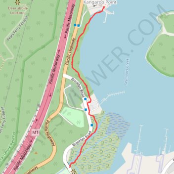
Name: Kangaroo Point Boardwalk trail, distance, elevation, map, profile, GPS track
Coordinates: -33.54955 151.19786 -33.54196 151.19981
Other hiking, mountain biking, running and outdoor activity trails
Click on a trail to view its statistics, map and profile.