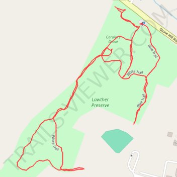
Lawther Preserve - Carolin's Grove Track
- Distance: 1.5 mi
- Elevation gain: 14 m
- Maximum elevation: 193 m
- Elevation loss: 14 m
- Minimum elevation: 180 m
- Moving time: 34 m 33 s
- Moving speed: 2.7 mph
- Maximum speed: 5.6 mph
- Total time: 36 m 40 s
- Global speed: 2.5 mph
Interactive trail map
Trail profile
- Distance: 1.5 mi
- Elevation gain: 14 m
- Maximum elevation: 193 m
- Elevation loss: 14 m
- Minimum elevation: 180 m
- Moving time: 34 m 33 s
- Moving speed: 2.7 mph
- Maximum speed: 5.6 mph
- Total time: 36 m 40 s
- Global speed: 2.5 mph
About this trail
Name: Lawther Preserve - Carolin's Grove Track trail, distance, elevation, map, profile, GPS track
Coordinates: 41.20948 -73.58067 41.21365 -73.57586
Other hiking, mountain biking, running and outdoor activity trails
Click on a trail to view its statistics, map and profile.